Origins
 The area now known as King’s Cross lay approximately 2 km north-west of the Roman settlement of Londinium. Roman remains suggest it may have been the site of a crossing of the Fleet River. It is also believed to be the location of the legendary battle between Queen Boudicca and Roman invaders. The story goes that the final resting place of Boudicca, the warrior queen of the Iceni, is under Platform nine at King’s Cross Station.
She ended up there following her last battle with the Romans in AD 61. The battle took place at Broad Ford, in the valley between King’s Cross and St Pancras. Broad Ford was the place to cross the Fleet and according to tradition it became Battle Bridge, following Boudicca’s defeat.
A mission of Roman monks arrived in Essex in AD 597 with the relics of the martyr saint St Pancras. Their aim was to convert Britain to Christianity. The monks built a church in the place where St Pancras Old Church is today, making the site one of the oldest places of Christian worship in Europe.
After an initial burst of popularity, the church began to suffer from being off the beaten track. And even as London expanded in the 18th Century, King’s Cross remained predominantly rural.
18th Century
A map from 1745 shows the King’s Cross site as open fields adjacent to York Way (formerly Longwich Lane and then Maiden Lane). This road, and Pancras Road (formerly King’s Road), were traditional routes out of London to the north. Dotted throughout the fields were small settlements, such as Battle Bridge. The area was popular with Londoners escaping the city to health spas and country inns. It was also the route to and from Kentish Town, Highgate and Hampstead. These were retirement and commuter villages even in the 18th Century.
Euston Road (known as ‘The New Road’ until 1857) was completed in 1756. This kick-started development on the southern part of the King’s Cross site. Buildings were generally low quality two-storey terraced houses but also included the Small Pox Hospital, built in 1793-4, and the Fever Hospital completed in 1802.
19th Century
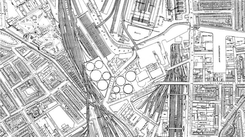
With the completion of the Regent’s Canal in 1820, King’s Cross was linked to major industrial cities in the north of England. Another feature of the area’s growing industrial importance was the arrival of the Imperial Gas Light and Coke Company. The company opened Pancras Gasworks to the south of the canal in 1824.
During this same period a number of other “polluting” businesses such as paint manufacture and refuse sorting were established in the area, particularly in Battle Bridge. Much of the land to the north of the canal remained open fields. In a move to raise the rather tarnished image of the area, a statue of King George IV was erected at the Battle Bridge crossroads in 1830. The statue attracted ridicule and was demolished in 1842, but the new name for the area – ‘King’s Cross’ – stuck.
Between 1849 and 1852 the Great Northern Railway (GNR) developed their London terminus in the area. The GNR purchased land for the station to the south of the canal and land to the north for its goods station and steam locomotive depot.
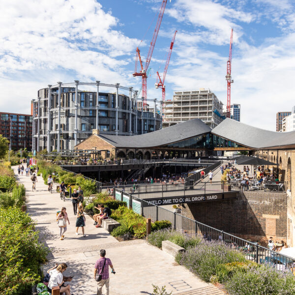
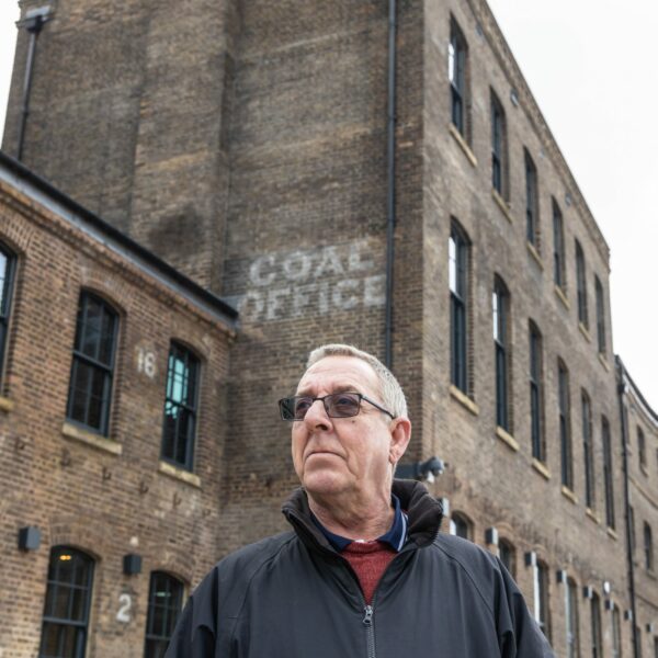
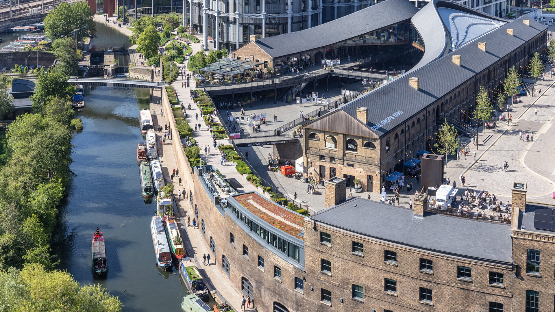
The first temporary passenger station opened in 1850 to the north of the canal. This station was used until King’s Cross station opened in 1852. The Great Northern Hotel opened in 1854, largely for the patrons of the railway. The temporary station became part of the wholesale Potato Market. Grain, another valuable commodity, was transported from East Anglia and stored in the specially constructed Goods Yard complex (1850-2) before being transported on across London. Coal was stored in the Eastern Coal Drops (1851) and Western Coal Drops (1860s). Various inlets allowed transfer direct from trains to barges on the canal.
D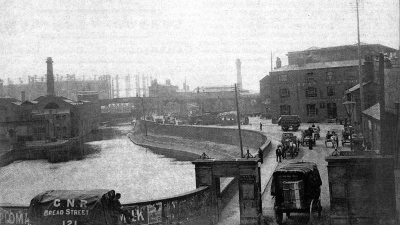 evelopment was not limited to industrial expansion. By the end of 1850s, the construction of residential buildings was well advanced. Lower quality housing was built along the Caledonian Road and more expensive properties in Barnsbury. On the western side of King’s Cross, the terraces and squares of Somers Town, continued to be built. These were now occupied by railway and industrial workers rather than the genteel middle class. An area between Somers Town and the Goods Yard was leased to workmen to build their own homes and quickly became associated with poor quality dwellings, known as Agar Town.
Agar Town and areas of Somers Town were redeveloped in the 1860s to create space for the tracks, terminus and goods yards of the Midland Railway. This included St Pancras, built between 1866 and 1868, and the Midland Grand Hotel completed in 1876. The German Gymnasium was built in 1864-5 as a club and sports facility for the German Gymnastics Society.
The Metropolitan Railway, the world’s first underground railway running along the route of the Euston Road, was also completed at this time. The cut and cover method was used to build the tunnels. The first tube trains were steam engines which caused considerable pollution – but were popular due to their speed and efficiency.
Major increases in rail traffic necessitated the widening of the railway lines into King’s Cross Station and the extension of the station on its west side. Several of the gasholders were also expanded in the 1880s and by 1900, Pancras Gasworks covered 11 acres.
More housing was knocked down for this expansion and by the mid 19th century onwards it became more difficult for railway workers to find decent affordable housing close to their place of work. As a consequence, the Improved Industrial Dwellings Society built the Stanley Buildings to accommodate 104 families in 1864-5 to the west of King’s Cross station.
 20th Century
After the havoc of wartime and the Nationalisation of 1948, the transport of freight by rail suffered a speedy decline. In the southern part of the Goods Yard, most of the rail lines were lifted in the 1980’s.
Although six gasholders remained in service until 2000, the area went from being a busy industrial and distribution district to an under-used site. Many buildings became derelict. This had an impact on local communities whose residents lost opportunities for work and associated trade from the business of the goods yards.
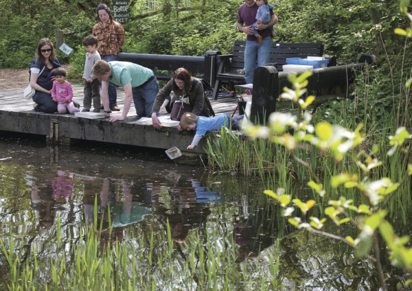
A number of projects tried to improve the area such as Camley Street Natural Park. This community wildlife reserve was established in the 1980s just to the west of the Regent’s Canal . In the latter part of the 1990s, the area became know for its night life and was something of a hub for artists and creative organisations. But problems of crime, unemployment and a poor quality environment undermined the area.
 21st Century
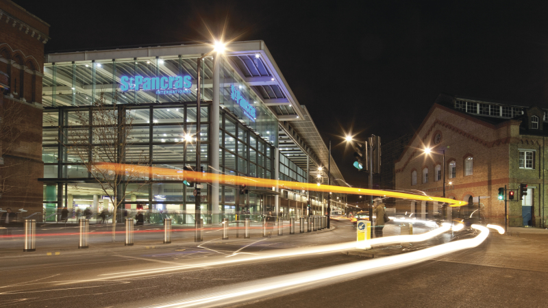
The arrival of the 21st Century has seen some significant changes that have kick-started the next chapter in the history of King’s Cross. In July 2001, construction work started on the Channel Tunnel Rail Link and the restoration and extension of St Pancras Station. Since then, the area around King’s Cross has seen an investment of over £2.5 billion on transport infrastructure.
In 2007 the new St Pancras International terminus opened. The Midland Hotel was restored and reopened as St Pancras Renaissance. The area has also seen an incredible flow of investment into world-class buildings such as the Francis Crick Institute and King’s Place. These changes have acted as a catalyst for further development and have helped change perceptions of King’s Cross.
King’s Cross is a model of constructive conservation that captures the special quality of London as it has grown over the centuries.
English Heritage